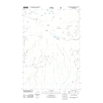
2011 Map of Ramshorn Mountain
USGS Topo · Published 2011About this map
High-altitude extraction and water management define this portion of Madison County, where the peak of Ramshorn Mountain overlooks a landscape heavily marked by historical mining activity. The concentration of claims and infrastructure, such as the Missouri Millsite and the South Meadow Creek Dam, suggests a systematic approach to processing ore near the headwaters of South Meadow Creek. This alpine environment is pocketed with small water bodies like Mine Lake and South Meadow Lake, which likely served as critical resources for the surrounding operations.
Find a feature on this map
50 named features on this map. Tap any name to fly to it.
Don’t see what you’re looking for? This feature index may not catch every label — zoom into the map to look around manually.
Map Details
Editions of this 2011 Ramshorn Mountain Map
This is the sole edition of this map. No revisions or reprints were ever made.
Other maps of this area

1888 · Three Forks
USGS Topo · 1:250,000

1893 · Dillon
USGS Topo · 1:250,000

1894 · Three Forks
USGS Topo · 1:250,000

1895 · Three Forks
USGS Topo · 1:250,000

1947 · Bozeman
USGS Topo · 1:250,000

1948 · Bozeman
USGS Topo · 1:250,000

1950 · Harrison
USGS Topo · 1:62,500

1950 · Virginia City
USGS Topo · 1:62,500

1955 · Bozeman
USGS Topo · 1:250,000

1955 · Dillon
USGS Topo · 1:250,000