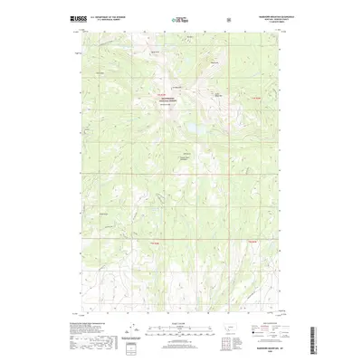
2020 Map of Ramshorn Mountain
USGS Topo · Published 2020About this map
The Tobacco Root Mountains dominate this high-elevation landscape within the Beaverhead National Forest, where steep ridgelines and alpine basins create a complex drainage network. Water is a defining element of this terrain, with several small lakes including Mine Lake, McKelvey Lake, and Cliff Lake tucked beneath the northern peaks. Prominent summits like Ramshorn Mtn, South Baldy Mtn, and Ward Peak frame the deep drainages of Ramshorn Creek and Granite Creek. The map reveals a land shaped by both natural features and human movement, indicated by routes such as Mill Gulch Rd and Granite Creek Rd. From the high point of Pedro Point to the sheltered Mill Gulch Spring, the area serves as a primary watershed for the surrounding region, feeding numerous forks and gulches like Kings Gulch and California Creek.
Find a feature on this map
43 named features on this map. Tap any name to fly to it.
Don’t see what you’re looking for? This feature index may not catch every label — zoom into the map to look around manually.
Map Details
Editions of this 2020 Ramshorn Mountain Map
This is the sole edition of this map. No revisions or reprints were ever made.
Other maps of this area

1888 · Three Forks
USGS Topo · 1:250,000

1893 · Dillon
USGS Topo · 1:250,000

1894 · Three Forks
USGS Topo · 1:250,000

1895 · Three Forks
USGS Topo · 1:250,000

1947 · Bozeman
USGS Topo · 1:250,000

1948 · Bozeman
USGS Topo · 1:250,000

1950 · Harrison
USGS Topo · 1:62,500

1950 · Virginia City
USGS Topo · 1:62,500

1955 · Bozeman
USGS Topo · 1:250,000

1955 · Dillon
USGS Topo · 1:250,000