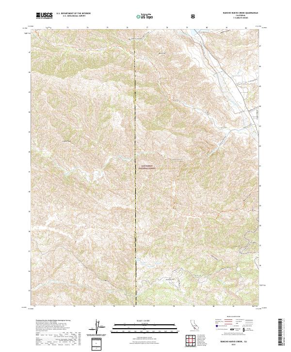
2021 Map of Rancho Nuevo Creek
USGS Topo · Published 2021About this map
Los Padres National Forest spans the high-elevation backcountry of the Santa Barbara and Ventura county line, where the drainage of Rancho Nuevo Creek meets the northern flow of the Cuyama River. This high-country landscape is defined by its network of forest routes and trails, including the Rancho Nuevo Trail and the Potrero Seco Road, which connect isolated water sources like La Jolla Springs and Oak Spring.
Find a feature on this map
40 named features on this map. Tap any name to fly to it.
Don’t see what you’re looking for? This feature index may not catch every label — zoom into the map to look around manually.
Map Details
Editions of this 2021 Rancho Nuevo Creek Map
This is the sole edition of this map. No revisions or reprints were ever made.
Other maps of this area

1902 · Santa Ynez
USGS Topo · 1:125,000

1903 · Mt. Pinos
USGS Topo · 1:125,000

1905 · Santa Ynez
USGS Topo · 1:125,000

1942 · Wheeler Springs
USGS Topo · 1:24,000

1943 · Rancho Nuevo Creek
USGS Topo · 1:24,000

1943 · Old Man Mountain
USGS Topo · 1:24,000

1943 · Apache Canyon
USGS Topo · 1:24,000

1943 · Cuyama Peak
USGS Topo · 1:24,000

1943 · Reyes Peak
USGS Topo · 1:24,000

1943 · Wheeler Springs
USGS Topo · 1:24,000