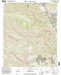
1995 Map of Rancho Nuevo Creek
USGS Topo · Published 2000About this map
Dick Smith Wilderness and the Matilija Wilderness dominate this pocket of the California backcountry, where the Santa Barbara and Ventura county line cuts through high-elevation terrain. This late-twentieth-century study shows a landscape defined by seasonal waterways and primitive access, as the Cuyama River flows in the northeast while several campsites, including Upper Rancho Nuevo Campsite and Deal Junction Campsite, mark the intersection of deep canyons.
Find a feature on this map
36 named features on this map. Tap any name to fly to it.
Don’t see what you’re looking for? This feature index may not catch every label — zoom into the map to look around manually.
Map Details
Editions of this 1995 Rancho Nuevo Creek Map
This is the sole edition of this map. No revisions or reprints were ever made.
Other maps of this area

1902 · Santa Ynez
USGS Topo · 1:125,000

1903 · Mt. Pinos
USGS Topo · 1:125,000

1905 · Santa Ynez
USGS Topo · 1:125,000

1942 · Wheeler Springs
USGS Topo · 1:24,000

1943 · Rancho Nuevo Creek
USGS Topo · 1:24,000

1943 · Old Man Mountain
USGS Topo · 1:24,000

1943 · Apache Canyon
USGS Topo · 1:24,000

1943 · Cuyama Peak
USGS Topo · 1:24,000

1943 · Reyes Peak
USGS Topo · 1:24,000

1943 · Wheeler Springs
USGS Topo · 1:24,000