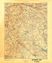
1900 Map of Rancocas
USGS Topo · Published 1913About this map
The North Br. Rancocas Cr. and its complex network of tributaries define the settlement patterns of the New Jersey Pine Barrens at the close of the nineteenth century. Industry and agriculture are closely tied to the water, evidenced by Hanover Furnace and the widespread irrigation for the Jobstown Bog and Friendship Bogs. The landscape transitions from the more densely populated western edge near Moorestown and Stanwick into the sandy interior where small, isolated villages like Ong Hat and Retreat sit among the pines.
Find a feature on this map
261 named features on this map. Tap any name to fly to it.
Don’t see what you’re looking for? This feature index may not catch every label — zoom into the map to look around manually.
Map Details
Editions of this 1900 Rancocas Map
2 editions found

Other maps of this area

1884 · Whitings
USGS Topo · 1:62,500

1887 · Atlantic City
USGS Topo · 1:62,500

1888 · Bordentown
USGS Topo · 1:62,500

1888 · Pemberton
USGS Topo · 1:62,500

1888 · Little Egg Harbor
USGS Topo · 1:62,500

1888 · Mount Holly
USGS Topo · 1:62,500

1888 · Cassville
USGS Topo · 1:62,500

1888 · Whitings
USGS Topo · 1:62,500

1890 · Great Egg Harbor
USGS Topo · 1:62,500

1890 · Hammonton
USGS Topo · 1:62,500
Featured Places
- Cherry Hill Township, NJ
- Vineland, NJ
- Sicklerville, Winslow Township
- Mount Laurel Township, NJ
- Winslow Township, NJ