
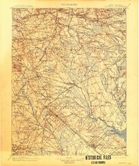
1900 Map of Rancocas
USGS Topo · Published 1900About this map
Mount Laurel and the surrounding Pine Barrens appear here at the close of the nineteenth century, showing a landscape defined by milling and a dense network of early rail lines. Small agricultural and industrial centers like Vincentown, Medford, and Lumberton are connected by branches of the Pennsylvania R. R. and the Central Railroad of New Jersey. The eastern portion of the map reveals the characteristic settlement patterns of the Pinelands, where isolated mills such as Jones Mill, Burrs Mill, and Ballingers Mill utilize the region's water resources. Notable geographic features include the elevation at Apple Pie Hill and the sprawling Great Swamp. This survey reflects an era when timber and bog iron industries were being succeeded by agriculture and cranberry cultivation, as seen at the West Jersey Cranberry Meadow near the Mullica River.
Find a feature on this map
284 named features on this map. Tap any name to fly to it.
Don’t see what you’re looking for? This feature index may not catch every label — zoom into the map to look around manually.
Map Details
Editions of this 1900 Rancocas Map
2 editions found
Other maps of this area

1884 · Whitings
USGS Topo · 1:62,500

1887 · Atlantic City
USGS Topo · 1:62,500

1888 · Bordentown
USGS Topo · 1:62,500

1888 · Pemberton
USGS Topo · 1:62,500

1888 · Little Egg Harbor
USGS Topo · 1:62,500

1888 · Mount Holly
USGS Topo · 1:62,500

1888 · Cassville
USGS Topo · 1:62,500

1888 · Whitings
USGS Topo · 1:62,500

1890 · Great Egg Harbor
USGS Topo · 1:62,500

1890 · Hammonton
USGS Topo · 1:62,500
Featured Places
- Cherry Hill Township, NJ
- Vineland, NJ
- Sicklerville, Winslow Township
- Mount Laurel Township, NJ
- Winslow Township, NJ