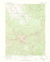
1956 Map of Rand
USGS Topo · Published 1969About this map
The high-altitude ranching and timber country of Jackson County is defined here by the confluence of the Illinois River and Owl Creek. This 1950s landscape centers on the small settlement of Rand, surrounded by a network of family-held properties such as Howard Ranch, Fuqua Ranch, and the Donelson Ranch. The survey documents a working landscape where water rights and cattle grazing were paramount, illustrated by the numerous named ditches and gaging stations along McKirahan Creek and Willow Creek.
Find a feature on this map
117 named features on this map. Tap any name to fly to it.
Don’t see what you’re looking for? This feature index may not catch every label — zoom into the map to look around manually.
Map Details
Editions of this 1956 Rand Map
3 editions found

Other maps of this area

1915 · Longs Peak
USGS Topo · 1:125,000

1916 · Home
USGS Topo · 1:125,000

1919 · Rocky Mountain National Park
USGS Topo · 1:125,000

1920 · Home
USGS Topo · 1:125,000

1954 · Greeley
USGS Topo · 1:250,000

1954 · Craig
USGS Topo · 1:250,000

1955 · Gould
USGS Topo · 1:24,000

1955 · Owl Ridge
USGS Topo · 1:24,000

1955 · Mac Farlane Reservoir
USGS Topo · 1:24,000

1955 · Walden
USGS Topo · 1:62,500