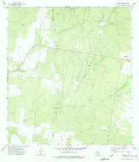
1972 Map of Randado
USGS Topo · Published 1975About this map
The boundary between Zapata Co Jim Hogg Co defines the landscape of this South Texas brush country during the early 1970s. The region is characterized by an extensive network of energy extraction, dominated by the Randado Oil Field and the South Manila Oil Field. Scores of Oil Wells, Gas Wells, and Drill Holes are connected by a system of pipelines that cut across the undulating terrain.
Find a feature on this map
17 named features on this map. Tap any name to fly to it.
Don’t see what you’re looking for? This feature index may not catch every label — zoom into the map to look around manually.
Map Details
Editions of this 1972 Randado Map
This is the sole edition of this map. No revisions or reprints were ever made.
Other maps of this area

1938 · Cuevitas
USGS Topo · 1:62,500

1939 · Randado
USGS Topo · 1:62,500

1940 · Randado
USGS Topo · 1:62,500

1940 · Mogotes Hill
USGS Topo · 1:62,500

1949 · Mc Allen
USGS Topo · 1:250,000

1954 · McAllen
USGS Topo · 1:250,000

1956 · Mogotes Hill
USGS Topo · 1:62,500

1956 · Arroyo Clareno
USGS Topo · 1:62,500

1956 · Laredo
USGS Topo · 1:250,000

1957 · Mc Allen
USGS Topo · 1:250,000