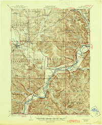
1923 Map of Randolph
USGS Topo · Published 1945About this map
The Allegheny River valley forms the central axis of this 1920s survey, winding through the Allegheny Indian Reservation and the early boundaries of Alleghany State Park. The landscape is a dense network of rural school districts and small rail-oriented settlements that define the era's social geography. Key transit points like Quaker Bridge and Steamburg serve the river corridor, while the Erie and New York Central railroads provide vital connections for timber and agricultural transport.
Find a feature on this map
109 named features on this map. Tap any name to fly to it.
Don’t see what you’re looking for? This feature index may not catch every label — zoom into the map to look around manually.
Map Details
Editions of this 1923 Randolph Map
4 editions found
Other maps of this area

1900 · Cherry Creek
USGS Topo · 1:62,500

1900 · Salamanca
USGS Topo · 1:62,500

1905 · Jamestown
USGS Topo · 1:62,500

1906 · Warren
USGS Topo · 1:62,500

1907 · Warren
USGS Topo · 1:62,500

1908 · Warren
USGS Topo · 1:62,500

1922 · Randolph
USGS Topo · 1:62,500

1923 · Randolph
USGS Topo · 1:62,500

1923 · Cattaraugus
USGS Topo · 1:62,500

1924 · Ellicottville
USGS Topo · 1:62,500