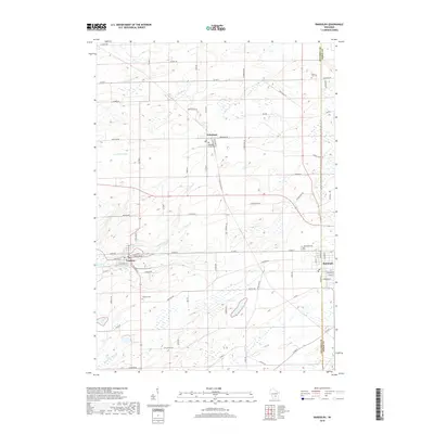
2018 Map of Randolph
USGS Topo · Published 2018About this map
Cambria and Randolph anchor the southern landscape of this Wisconsin survey, where the borders of Columbia and Dodge counties meet. The region is defined by a dense network of agricultural roads and a series of vital waterways, including the Fox River and the meandering N Br Duck Cr, which feeds into Tarrant Lake. This modern record reveals a well-established rural infrastructure, where local life centers around concentrated village hubs and the surrounding farmstead plots connected by routes like Co Rd M and Friesland Rd.
Find a feature on this map
65 named features on this map. Tap any name to fly to it.
Don’t see what you’re looking for? This feature index may not catch every label — zoom into the map to look around manually.
Map Details
Editions of this 2018 Randolph Map
This is the sole edition of this map. No revisions or reprints were ever made.
Other maps of this area

1955 · Randolph
USGS Topo · 1:62,500

1955 · Columbus
USGS Topo · 1:62,500

1955 · Beaver Dam
USGS Topo · 1:62,500

1955 · Fox Lake
USGS Topo · 1:62,500

1957 · Madison
USGS Topo · 1:250,000

1960 · Madison
USGS Topo · 1:250,000

1980 · Fond Du Lac
USGS Topo · 1:100,000

1980 · Lost Lake
USGS Topo · 1:24,000
1980 · Manchester
USGS Topo · 1:24,000
1980 · Rio
USGS Topo · 1:24,000