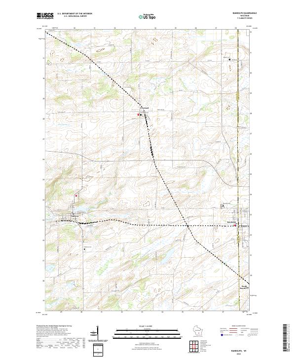
2022 Map of Randolph
USGS Topo · Published 2022About this map
Randolph and Cambria anchor the southern landscape of this agricultural region where Columbia and Dodge counties meet. The terrain is defined by a network of drainage systems, including the N Br Duck Cr and the headwaters of the Fox River. In the village of Cambria, development follows the shoreline of Tarrant Lake, while to the north, the smaller settlement of Friesland is surrounded by a high density of rural roads like E Friesland Rd and Co Rd EF. This contemporary survey reveals a well-established pattern of local burial grounds, such as Engedi Cem and Friesland Cem, which provide essential touchstones for family historians. The map also records the precise location of South Randolph, showing the area's ongoing reliance on a grid of county highways and local routes that link the farmsteads to these small central hubs.
Find a feature on this map
71 named features on this map. Tap any name to fly to it.
Don’t see what you’re looking for? This feature index may not catch every label — zoom into the map to look around manually.
Map Details
Editions of this 2022 Randolph Map
This is the sole edition of this map. No revisions or reprints were ever made.