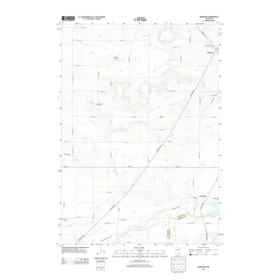
2013 Map of Randolph
USGS Topo · Published 2013About this map
Hampton and Randolph anchor this southern Dakota County landscape where the prairie begins to break into the drainage of the Cannon River. The terrain is defined by a dense network of local roads and family-named cemeteries that speak to generations of agricultural settlement. From the Saint Mathias Cem in the north to the Lakeside Cem near the shores of Lake Byllesby, the map preserves a detailed record of local genealogy. Smaller settlements like Castle Rock are situated along the tributaries of Chub Cr and Pine Cr, while landmarks such as Lucht Field Airport reflect more modern regional infrastructure. The southern boundary follows the Dakota Co and Goodhue Co line, tracing the natural path of the river through a mosaic of sectioned farmland and rural mail routes.
Find a feature on this map
62 named features on this map. Tap any name to fly to it.
Don’t see what you’re looking for? This feature index may not catch every label — zoom into the map to look around manually.
Map Details
Editions of this 2013 Randolph Map
This is the sole edition of this map. No revisions or reprints were ever made.
Other maps of this area

1953 · Saint Paul
USGS Topo · 1:250,000

1957 · Farmington
USGS Topo · 1:62,500

1957 · Hastings
USGS Topo · 1:62,500

1959 · Saint Paul
USGS Topo · 1:250,000

1960 · Northfield
USGS Topo · 1:24,000

1960 · Dennison
USGS Topo · 1:24,000

1968 · Sogn
USGS Topo · 1:24,000
1974 · Coates
USGS Topo · 1:24,000
1974 · Randolph
USGS Topo · 1:24,000
1974 · Castle Rock
USGS Topo · 1:24,000