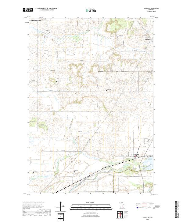
2022 Map of Randolph
USGS Topo · Published 2022About this map
Randolph and Hampton anchor this portion of southern Dakota County, where the agricultural landscape is carved by the winding course of the Cannon River and Chub Creek. The terrain is defined by a series of tributary networks, including the South Branch Vermillion River and Pine Creek, which flow through undulating townships. For family historians, the map is remarkably dense with burial grounds, ranging from Saint Mathias Cemetery near Hampton to the Castle Rock Valley Cemetery and the more remote Redrose Cemetery further south. The southern edge of the quadrangle is dominated by the waters of Lake Byllesby, a reservoir formed along the river. The grid of rural roads, such as Hampton Boulevard and Biscayne Avenue, connects small clusters like Castle Rock and Farmington, showing the enduring layout of these farming communities.
Find a feature on this map
77 named features on this map. Tap any name to fly to it.
Don’t see what you’re looking for? This feature index may not catch every label — zoom into the map to look around manually.
Map Details
Editions of this 2022 Randolph Map
This is the sole edition of this map. No revisions or reprints were ever made.
Other maps of this area

1953 · Saint Paul
USGS Topo · 1:250,000

1957 · Farmington
USGS Topo · 1:62,500

1957 · Hastings
USGS Topo · 1:62,500

1959 · Saint Paul
USGS Topo · 1:250,000

1960 · Northfield
USGS Topo · 1:24,000

1960 · Dennison
USGS Topo · 1:24,000

1968 · Sogn
USGS Topo · 1:24,000
1974 · Coates
USGS Topo · 1:24,000
1974 · Randolph
USGS Topo · 1:24,000
1974 · Castle Rock
USGS Topo · 1:24,000