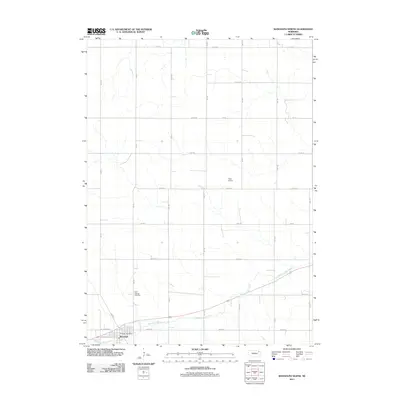
2011 Map of Randolph North
USGS Topo · Published 2011About this map
Middle Logan Creek meanders through the fertile agricultural lands of Cedar County, Nebraska, just north of the community of Randolph. This 2011 topographic record reveals the strictly organized township and range grid that defines the local landscape, with numbered avenues and roads like 561 Ave and 870th Rd sectioning the countryside. On the northern outskirts of town, Saint Frances Cemetery and the Randolph Post Office serve as primary landmarks for local history and genealogy. The presence of Thies Airport in the central portion of the map highlights the modern aviation infrastructure supporting this rural community. Within Randolph itself, the intersection of W Jackson St and W Wayne St marks the beginning of the residential and commercial district that anchors this portion of northeast Nebraska.
Find a feature on this map
25 named features on this map. Tap any name to fly to it.
Don’t see what you’re looking for? This feature index may not catch every label — zoom into the map to look around manually.
Map Details
Editions of this 2011 Randolph North Map
This is the sole edition of this map. No revisions or reprints were ever made.
Other maps of this area

1955 · Sioux City
USGS Topo · 1:250,000

1958 · Sioux City
USGS Topo · 1:250,000

1959 · Sioux City
USGS Topo · 1:250,000

1968 · Coleridge
USGS Topo · 1:24,000

1968 · Hartington
USGS Topo · 1:24,000

1968 · Hartington SW
USGS Topo · 1:24,000

1971 · Belden
USGS Topo · 1:24,000

1971 · Randolph South
USGS Topo · 1:24,000

1971 · Randolph North
USGS Topo · 1:24,000
1971 · Randolph SW
USGS Topo · 1:24,000