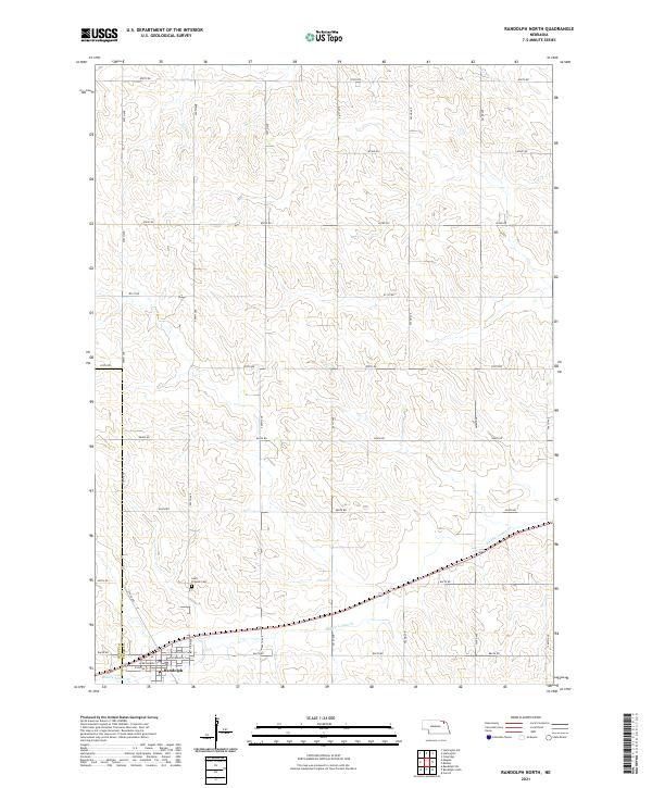
2021 Map of Randolph North
USGS Topo · Published 2021About this map
Randolph sits at the southwestern edge of this survey, where the border between Pierce Co and Cedar Co meets. The town's grid is detailed with residential and commercial streets, including W Broadway St and E Jackson St. North of the town center, the Saint Frances Cem provides a notable landmark for genealogists and local historians. This region is characterized by a dense network of section roads that navigate the undulating terrain typical of northeast Nebraska.
Find a feature on this map
30 named features on this map. Tap any name to fly to it.
Don’t see what you’re looking for? This feature index may not catch every label — zoom into the map to look around manually.
Map Details
Editions of this 2021 Randolph North Map
This is the sole edition of this map. No revisions or reprints were ever made.
Other maps of this area

1955 · Sioux City
USGS Topo · 1:250,000

1958 · Sioux City
USGS Topo · 1:250,000

1959 · Sioux City
USGS Topo · 1:250,000

1968 · Coleridge
USGS Topo · 1:24,000

1968 · Hartington
USGS Topo · 1:24,000

1968 · Hartington SW
USGS Topo · 1:24,000

1971 · Belden
USGS Topo · 1:24,000

1971 · Randolph South
USGS Topo · 1:24,000

1971 · Randolph North
USGS Topo · 1:24,000
1971 · Randolph SW
USGS Topo · 1:24,000