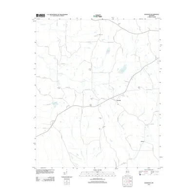
2012 Map of Randolph
USGS Topo · Published 2012About this map
The Yocona River and its numerous tributaries, including Kittahutty Cr and Indian Cr, define the landscape of Pontotoc County in this 2012 survey. Centered on the community of Randolph, the area shows a high density of family and community burial sites, such as Salmon Cem, Herndon Cem, and Carey Springs Cem, which serve as vital landmarks for local genealogical research. To the south lies the settlement of Hebron, connected by a network of rural roads like Co RD-177 and Horn Creek RD.
Find a feature on this map
73 named features on this map. Tap any name to fly to it.
Don’t see what you’re looking for? This feature index may not catch every label — zoom into the map to look around manually.
Map Details
Editions of this 2012 Randolph Map
This is the sole edition of this map. No revisions or reprints were ever made.
Other maps of this area

1942 · Denmark
USGS Topo · 1:62,500

1943 · Denmark
USGS Topo · 1:62,500

1949 · New Albany
USGS Topo · 1:62,500

1951 · New Albany
USGS Topo · 1:62,500

1956 · Tupelo
USGS Topo · 1:250,000

1958 · Tupelo
USGS Topo · 1:250,000

1972 · Houlka
USGS Topo · 1:24,000

1972 · Robbs
USGS Topo · 1:24,000

1972 · Randolph
USGS Topo · 1:24,000
1972 · Southwest Pontotoc
USGS Topo · 1:24,000