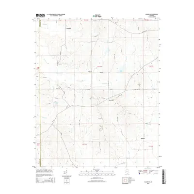
2015 Map of Randolph
USGS Topo · Published 2015About this map
Toccopola and Randolph anchor this rural Mississippi landscape, situated along the undulating drainage basins of the Yocona River and its tributaries. The area is characterized by a dense network of family-named cemeteries that speak to the deep genealogical roots of Pontotoc County, including Guinn Cem, Salmon Cem, and the Harrison-Tutor Cem. The presence of Campyocona near the center of the map suggests a long-standing community focal point in this upland terrain. Water management and local recreation are evident through features like Honeyfork Lake and Guinn Lake, while the intricate web of county roads like Boy Scout Rd and Antioch Rd connects isolated homesteads and local settlements. The map also captures the transition between county lines, where Lafayette and Calhoun counties meet the western and southern edges of Pontotoc.
Find a feature on this map
79 named features on this map. Tap any name to fly to it.
Don’t see what you’re looking for? This feature index may not catch every label — zoom into the map to look around manually.
Map Details
Editions of this 2015 Randolph Map
This is the sole edition of this map. No revisions or reprints were ever made.
Other maps of this area

1942 · Denmark
USGS Topo · 1:62,500

1943 · Denmark
USGS Topo · 1:62,500

1949 · New Albany
USGS Topo · 1:62,500

1951 · New Albany
USGS Topo · 1:62,500

1956 · Tupelo
USGS Topo · 1:250,000

1958 · Tupelo
USGS Topo · 1:250,000

1972 · Houlka
USGS Topo · 1:24,000

1972 · Robbs
USGS Topo · 1:24,000

1972 · Randolph
USGS Topo · 1:24,000
1972 · Southwest Pontotoc
USGS Topo · 1:24,000