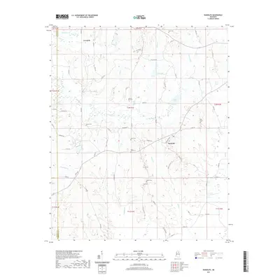
2021 Map of Randolph
USGS Topo · Published 2021About this map
Toccopola and Randolph anchor this rural Mississippi landscape, situated along the county line between Lafayette and Pontotoc. The area is defined by the winding course of the Yocona River and its numerous tributaries, including Toccopola Cr, Honeyfork Cr, and Little Cr. This network of waterways historically shaped the settlement patterns and agricultural development of the region, creating a drainage basin that feeds into Yocona Lake and Guinn Lake.
Find a feature on this map
73 named features on this map. Tap any name to fly to it.
Don’t see what you’re looking for? This feature index may not catch every label — zoom into the map to look around manually.
Map Details
Editions of this 2021 Randolph Map
This is the sole edition of this map. No revisions or reprints were ever made.
Other maps of this area

1942 · Denmark
USGS Topo · 1:62,500

1943 · Denmark
USGS Topo · 1:62,500

1949 · New Albany
USGS Topo · 1:62,500

1951 · New Albany
USGS Topo · 1:62,500

1956 · Tupelo
USGS Topo · 1:250,000

1958 · Tupelo
USGS Topo · 1:250,000

1972 · Houlka
USGS Topo · 1:24,000

1972 · Robbs
USGS Topo · 1:24,000

1972 · Randolph
USGS Topo · 1:24,000
1972 · Southwest Pontotoc
USGS Topo · 1:24,000