2024 Map of Randolph
USGS Topo · Published 2024About this map
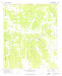
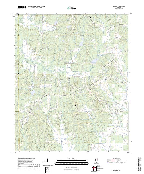
Toccopola and Randolph anchor this rural landscape in Pontotoc County, where the terrain is defined by the winding course of the Yocona River. The map reveals a deeply rooted community structure, evidenced by the numerous family and church burial grounds scattered across the countryside, including Guinn Cem, Bramlett Cem, and Tutor Cem. A distinct concentration of these sites along the Yocona River and its tributaries, such as Honeycyork Creek and Guinn Creek, suggests the historical importance of these watercourses for early settlement and movement.
Find a feature on this map
76 named features on this map. Tap any name to fly to it.
Don’t see what you’re looking for? This feature index may not catch every label — zoom into the map to look around manually.
Map Details
Editions of this 2024 Randolph Map
This is the sole edition of this map. No revisions or reprints were ever made.
Historical Maps of Toccopola Through Time
6 maps found