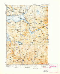
1933 Map of Rangeley
USGS Topo · Published 1941About this map
Rangeley serves as the hub of this Maine landscape during the early 1930s, situated between the sprawling waters of Rangeley Lake and Haley Pond. The map reveals a transition in the local economy and infrastructure, notably marking several rail lines as Abandoned while highlighting the emerging recreational significance of the area. Outdoor heritage is prominent, with the Appalachian Trail and Bemis Trail winding through high peaks like Saddleback Mtn, where a Fire Tower stood watch.
Find a feature on this map
114 named features on this map. Tap any name to fly to it.
Don’t see what you’re looking for? This feature index may not catch every label — zoom into the map to look around manually.
Map Details
Editions of this 1933 Rangeley Map
2 editions found

Other maps of this area

1926 · Dixfield
USGS Topo · 1:62,500

1927 · Rumford
USGS Topo · 1:48,000

1928 · Stratton
USGS Topo · 1:48,000

1929 · Phillips
USGS Topo · 1:48,000

1929 · Dixfield
USGS Topo · 1:62,500

1930 · Rumford
USGS Topo · 1:62,500

1931 · Cupsuptic
USGS Topo · 1:48,000

1932 · Phillips
USGS Topo · 1:62,500

1932 · Stratton
USGS Topo · 1:62,500

1932 · Kennebago Lake
USGS Topo · 1:48,000
Featured Places
- Rangeley, ME
- Dallas Plantation, ME
- Rangeley Plantation, ME
- Madrid Township, ME
- Sandy River Plantation, ME