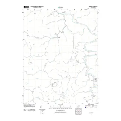
2011 Map of Ranger
USGS Topo · Published 2011About this map
The Guyandotte River carves a deep path through Lincoln County, shaping the life and settlement patterns of this West Virginia landscape. The riverfront towns of Atenville and Harts serve as local hubs, while smaller settlements like Wewanta are tucked further back along the many drainages. This area is characterized by an exceptional density of family burial grounds, such as the Hatfield Cemetery, Brumfield Cemetery, and Saunders Cemetery, which dot the hillsides and hollows, providing significant data for genealogical research.
Find a feature on this map
91 named features on this map. Tap any name to fly to it.
Don’t see what you’re looking for? This feature index may not catch every label — zoom into the map to look around manually.
Map Details
Editions of this 2011 Ranger Map
This is the sole edition of this map. No revisions or reprints were ever made.
Other maps of this area

1887 · Warfield
USGS Topo · 1:125,000

1891 · Warfield
USGS Topo · 1:125,000

1892 · Huntington
USGS Topo · 1:125,000

1898 · Huntington
USGS Topo · 1:125,000

1902 · Midkiff
USGS Topo · 1:62,500

1907 · Midkiff
USGS Topo · 1:62,500

1909 · Wayne
USGS Topo · 1:62,500

1909 · Midkiff
USGS Topo · 1:62,500

1910 · Holden
USGS Topo · 1:48,000

1910 · Naugatuck
USGS Topo · 1:48,000