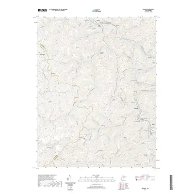
2019 Map of Ranger
USGS Topo · Published 2019About this map
The Guyandotte River winds through the heart of Lincoln and Wayne Counties, anchoring a landscape defined by its many hollows and river crossings. In the settlement of Ranger, the Ranger Beam Span Bridge serves as a key transit point, while further downstream near Harts, the Hartland Coal Haul Bridge and Harts Creek Bridge indicate the industrial and logistical importance of the river corridor. The map reveals a deeply established social fabric evidenced by dozens of family burial grounds, such as Saunders Cem, Hatfield Cem, and the Jones Cemeteries near Jones Br. Narrow valleys like Short Bend Hollow and Barbers Hollow are connected by a web of county roads including Co HWY 52/1 and Guyan River Rd. High points like Mann Knob and Cove Knob overlook a terrain where small communities like Atenville and Gill are linked by the water and early transportation routes.
Find a feature on this map
124 named features on this map. Tap any name to fly to it.
Don’t see what you’re looking for? This feature index may not catch every label — zoom into the map to look around manually.
Map Details
Editions of this 2019 Ranger Map
This is the sole edition of this map. No revisions or reprints were ever made.
Other maps of this area

1887 · Warfield
USGS Topo · 1:125,000

1891 · Warfield
USGS Topo · 1:125,000

1892 · Huntington
USGS Topo · 1:125,000

1898 · Huntington
USGS Topo · 1:125,000

1902 · Midkiff
USGS Topo · 1:62,500

1907 · Midkiff
USGS Topo · 1:62,500

1909 · Wayne
USGS Topo · 1:62,500

1909 · Midkiff
USGS Topo · 1:62,500

1910 · Holden
USGS Topo · 1:48,000

1910 · Naugatuck
USGS Topo · 1:48,000