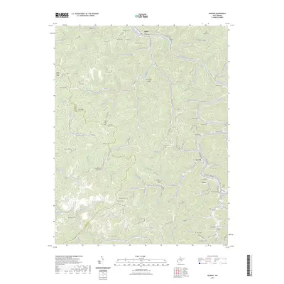
2023 Map of Ranger
USGS Topo · Published 2023About this map
The Guyandotte River carves a deep, winding path through this portion of the Lincoln and Wayne County border, dictating the layout of communities like Ranger and Harts. This landscape is defined by its extreme local relief, where narrow ridges like Ranger Ridge and isolated peaks such as Cove Knob separate tight hollows. The settlement pattern remains strictly confined to the valley floors, with homes and infrastructure following the winding courses of Fourteenmile Creek and Little Harts Creek.
Find a feature on this map
119 named features on this map. Tap any name to fly to it.
Don’t see what you’re looking for? This feature index may not catch every label — zoom into the map to look around manually.
Map Details
Editions of this 2023 Ranger Map
This is the sole edition of this map. No revisions or reprints were ever made.
Other maps of this area

1887 · Warfield
USGS Topo · 1:125,000

1891 · Warfield
USGS Topo · 1:125,000

1892 · Huntington
USGS Topo · 1:125,000

1898 · Huntington
USGS Topo · 1:125,000

1902 · Midkiff
USGS Topo · 1:62,500

1907 · Midkiff
USGS Topo · 1:62,500

1909 · Wayne
USGS Topo · 1:62,500

1909 · Midkiff
USGS Topo · 1:62,500

1910 · Holden
USGS Topo · 1:48,000

1910 · Naugatuck
USGS Topo · 1:48,000