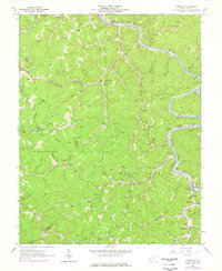
1962 Map of Ranger
USGS Topo · Published 1977About this map
The Guyandotte River carves a deep path through the dissected plateau of Lincoln and Wayne Counties, serving as the primary corridor for both the Chesapeake and Ohio railroad and the concentrated settlements of Ranger, Atenville, and Harts. This landscape is defined by its narrow hollows and numerous family-named landmarks, such as Saunders Cem, Hatfield Cem, and Brumfield Cem, which offer a clear window into the genealogical fabric of these valley communities. High points like Marin Knob, topped with a Lookout Tower, provide vantage points over the dense network of drainage systems including Fourteenmile Creek and Little Harts Creek. The map documents a rural infrastructure of local education and faith, evidenced by the distribution of Montana Ch, Sias Sch, and Harts High Sch along the winding river road and tucked-away forks.
Find a feature on this map
93 named features on this map. Tap any name to fly to it.
Don’t see what you’re looking for? This feature index may not catch every label — zoom into the map to look around manually.
Map Details
Editions of this 1962 Ranger Map
2 editions found
Other maps of this area

1887 · Warfield
USGS Topo · 1:125,000

1891 · Warfield
USGS Topo · 1:125,000

1892 · Huntington
USGS Topo · 1:125,000

1898 · Huntington
USGS Topo · 1:125,000

1902 · Midkiff
USGS Topo · 1:62,500

1907 · Midkiff
USGS Topo · 1:62,500

1909 · Wayne
USGS Topo · 1:62,500

1909 · Midkiff
USGS Topo · 1:62,500

1910 · Holden
USGS Topo · 1:48,000

1910 · Naugatuck
USGS Topo · 1:48,000