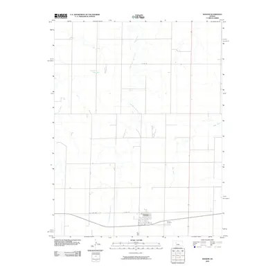
2009 Map of Ransom
USGS Topo · Published 2009About this map
Ransom serves as the central hub of this Ness County landscape, situated where Kansas Ave and 4th St define the town's small-grid interior. The surrounding High Plains terrain is etched by the drainage patterns of Sand Creek and its tributary, East Branch Sand Creek, which flow northward through the open country. A transition in local infrastructure is visible in the corridor of Old State Hwy 4, which runs parallel to the primary east-west transportation line near the town center.
Find a feature on this map
10 named features on this map. Tap any name to fly to it.
Don’t see what you’re looking for? This feature index may not catch every label — zoom into the map to look around manually.
Map Details
Editions of this 2009 Ransom Map
This is the sole edition of this map. No revisions or reprints were ever made.
Other maps of this area

1893 · Ellis
USGS Topo · 1:125,000

1955 · Great Bend
USGS Topo · 1:250,000

1955 · Scott City
USGS Topo · 1:250,000

1957 · Great Bend
USGS Topo · 1:250,000

1958 · Great Bend
USGS Topo · 1:250,000

1958 · Scott City
USGS Topo · 1:250,000

1966 · Ransom SE
USGS Topo · 1:24,000
1966 · Ransom SW
USGS Topo · 1:24,000

1966 · Utica SE
USGS Topo · 1:24,000
1974 · Gibson Creek
USGS Topo · 1:24,000