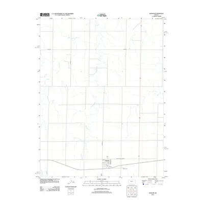
2012 Map of Ransom
USGS Topo · Published 2012About this map
Ransom is the focal point of this western Kansas landscape, positioned along the historical alignment of Old State Hwy Number 4. The town's grid is clearly defined by local thoroughfares such as Kansas Ave, Delaware Ave, and 1st St, with the central Po serving as a local anchor. The surrounding terrain is shaped by the subtle drainage patterns of Sand Cr and its tributaries, including E Br Sand Cr and Page Cr, which carve shallow paths through the agricultural sections. To the southeast of the main settlement, the Ransom Cem provides a specific point of interest for those researching local family histories and early burials. This survey illustrates the persistent geometry of the High Plains, where sections are divided by corridors like Co RD-478 and Co RD-533, maintaining the traditional layout of rural Ness County.
Find a feature on this map
15 named features on this map. Tap any name to fly to it.
Don’t see what you’re looking for? This feature index may not catch every label — zoom into the map to look around manually.
Map Details
Editions of this 2012 Ransom Map
This is the sole edition of this map. No revisions or reprints were ever made.
Other maps of this area

1893 · Ellis
USGS Topo · 1:125,000

1955 · Great Bend
USGS Topo · 1:250,000

1955 · Scott City
USGS Topo · 1:250,000

1957 · Great Bend
USGS Topo · 1:250,000

1958 · Great Bend
USGS Topo · 1:250,000

1958 · Scott City
USGS Topo · 1:250,000

1966 · Ransom SE
USGS Topo · 1:24,000
1966 · Ransom SW
USGS Topo · 1:24,000

1966 · Utica SE
USGS Topo · 1:24,000
1974 · Gibson Creek
USGS Topo · 1:24,000