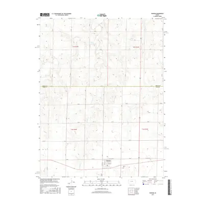
2015 Map of Ransom
USGS Topo · Published 2015About this map
Ransom serves as the central hub for this portion of the Kansas plains, situated at the junction of Old State Hwy 4 and a grid of rural section roads. The town's layout is defined by a traditional street grid including Kansas Ave, Kentucky Ave, and Ogden St. Just south of the main settlement lies the Ransom Cem, a key landmark for local genealogical research. The surrounding landscape is carved by the intermittent drainages of Sand Cr, E Br Sand Cr, and Page Cr, which dictate the topography across the Trego County and Ness County line. This 2015 survey illustrates a quintessential Western Kansas agricultural environment, where the rigid geometry of the Public Land Survey System meets the winding natural paths of prairie creeks.
Find a feature on this map
24 named features on this map. Tap any name to fly to it.
Don’t see what you’re looking for? This feature index may not catch every label — zoom into the map to look around manually.
Map Details
Editions of this 2015 Ransom Map
This is the sole edition of this map. No revisions or reprints were ever made.
Other maps of this area

1893 · Ellis
USGS Topo · 1:125,000

1955 · Great Bend
USGS Topo · 1:250,000

1955 · Scott City
USGS Topo · 1:250,000

1957 · Great Bend
USGS Topo · 1:250,000

1958 · Great Bend
USGS Topo · 1:250,000

1958 · Scott City
USGS Topo · 1:250,000

1966 · Ransom SE
USGS Topo · 1:24,000
1966 · Ransom SW
USGS Topo · 1:24,000

1966 · Utica SE
USGS Topo · 1:24,000
1974 · Gibson Creek
USGS Topo · 1:24,000