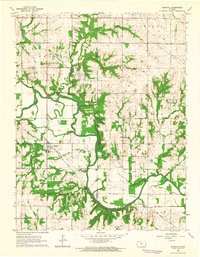
1963 Map of Rantoul
USGS Topo · Published 1964About this map
The Marais Des Cygnes River meanders sharply across this eastern Kansas landscape, carving a complex valley through the townships of Peoria, Richland, Stanton, and Cutler. In the early 1960s, the village of Rantoul served as a central hub along the Missouri Pacific railroad line, which cuts diagonally through the southern half of the quadrangle. The map captures a rural economy defined by agriculture and local resource extraction, evidenced by scattered oil wells and a quarry near the eastern boundary.
Find a feature on this map
20 named features on this map. Tap any name to fly to it.
Don’t see what you’re looking for? This feature index may not catch every label — zoom into the map to look around manually.
Map Details
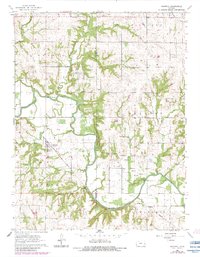
Editions of this 1963 Rantoul Map
2 editions found
Other maps of this area

1885 · Garnett
USGS Topo · 1:125,000

1885 · Lawrence
USGS Topo · 1:125,000

1887 · Olathe
USGS Topo · 1:125,000

1887 · Mound City
USGS Topo · 1:125,000

1889 · Lawrence
USGS Topo · 1:125,000

1893 · Mound City
USGS Topo · 1:125,000

1893 · Olathe
USGS Topo · 1:125,000

1894 · Garnett
USGS Topo · 1:125,000

1947 · Lawrence
USGS Topo · 1:250,000

1950 · Lawrence
USGS Topo · 1:250,000