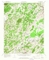
1961 Map of Rapidan
USGS Topo · Published 1967About this map
The confluence of the Robinson River and the Rapidan River anchors this central Virginia landscape at the start of the 1960s. The map illustrates a rural Piedmont region defined by small agricultural hubs like Brightwood, Locust Dale, and Mitchells. Educational and social institutions are prominent features, including the George Washington Carver Sch and the expansive grounds of the Woodberry Forest Sch near the riverbanks. The transportation network shows a transition in progress, with the Southern Railway corridor still active while an old railroad grade marks a discarded route to the south.
Find a feature on this map
94 named features on this map. Tap any name to fly to it.
Don’t see what you’re looking for? This feature index may not catch every label — zoom into the map to look around manually.
Map Details
Editions of this 1961 Rapidan Map
2 editions found

Other maps of this area

1887 · Spottsylvania
USGS Topo · 1:125,000

1892 · Spottsylvania
USGS Topo · 1:125,000

1892 · Gordonsville
USGS Topo · 1:125,000

1893 · Luray
USGS Topo · 1:125,000

1894 · Warrenton
USGS Topo · 1:125,000

1894 · Warrenton
USGS Topo · 1:62,500

1905 · Luray
USGS Topo · 1:125,000

1927 · Remington
USGS Topo · 1:48,000

1929 · Stony Man
USGS Topo · 1:48,000

1930 · Warrenton
USGS Topo · 1:62,500