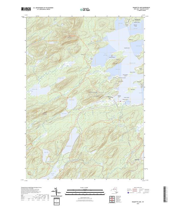
2023 Map of Raquette Lake
USGS Topo · Published 2023About this map
Raquette Lake dominates this Adirondack landscape, characterized by its intricate shoreline of bays and points that have long served as a hub for wilderness recreation and seasonal residency. The settlement of Raquette Lake serves as a central point, situated near Browns Tract Inlet and the Raquette Lake Railroad Trl, a path that preserves the legacy of early 20th-century rail access to these remote waters. To the south, the historic Sagamore area is accessible via Sagamore RD, reflecting the era of the Great Camps where architecture and landscape intertwined.
Find a feature on this map
85 named features on this map. Tap any name to fly to it.
Don’t see what you’re looking for? This feature index may not catch every label — zoom into the map to look around manually.
Map Details
Editions of this 2023 Raquette Lake Map
This is the sole edition of this map. No revisions or reprints were ever made.
Other maps of this area

1900 · Canada Lake
USGS Topo · 1:62,500

1901 · Old Forge
USGS Topo · 1:62,500

1903 · Big Moose
USGS Topo · 1:62,500

1903 · West Canada Lakes
USGS Topo · 1:62,500

1903 · Raquette Lake
USGS Topo · 1:62,500

1950 · Utica
USGS Topo · 1:250,000

1954 · Old Forge
USGS Topo · 1:62,500

1954 · West Canada Lakes
USGS Topo · 1:62,500
1954 · Raquette Lake
USGS Topo · 1:62,500

1954 · Big Moose
USGS Topo · 1:62,500