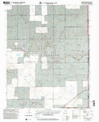
1998 Map of Rardin Hill
USGS Topo · Published 2001About this map
Kiowa National Grassland dominates this high-plains landscape where New Mexico meet the Oklahoma and Texas panhandles. Managed by the Cibola National Forest, the territory is defined by the drainage of Seneca Creek and significant topographical rises such as Rardin Hill and the prominent Rabbit Ear Mesa to the southwest. The presence of numerous named water sources like Barton Windmill, Messinger Windmill, and Dorizzi Windmill underscores the critical importance of groundwater for ranching in this arid tri-state border region. Human history is etched into the terrain at Creeds Chapel Cem and marked by Clarks Monument near the southern boundary. The infrastructure of the late 20th century is visible through the Booster Station Road and a major Pipeline cutting across Goodin Valley and Apache Draw, reflecting the area's role in regional energy transport.
Find a feature on this map
23 named features on this map. Tap any name to fly to it.
Don’t see what you’re looking for? This feature index may not catch every label — zoom into the map to look around manually.
Map Details
Editions of this 1998 Rardin Hill Map
This is the sole edition of this map. No revisions or reprints were ever made.
Other maps of this area

1954 · Dalhart
USGS Topo · 1:250,000

1958 · Dalhart
USGS Topo · 1:250,000

1962 · Dalhart
USGS Topo · 1:250,000

1969 · Felt SW
USGS Topo · 1:24,000

1969 · Wheeless
USGS Topo · 1:24,000

1970 · Clayton
USGS Topo · 1:24,000

1970 · Texline North
USGS Topo · 1:24,000

1972 · Seneca
USGS Topo · 1:24,000

1972 · Rardin Hill
USGS Topo · 1:24,000

1972 · Moses
USGS Topo · 1:24,000