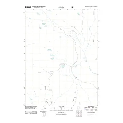
2011 Map of Rasmussen Lakes
USGS Topo · Published 2011About this map
Whiterocks River and its western fork dominate this high-elevation landscape, where a complex network of glacial basins and alpine waters define the terrain. The central namesake Rasmussen Lakes sit below Cirque Lake and Point Lake, feeding a drainage system that includes Upper Rock Lake, Middle Rock Lake, and Lower Rock Lake. This 2011 survey reveals an area managed for both recreation and water resources, evidenced by the Island Lake Dam and the Pole Creek Campground.
Find a feature on this map
48 named features on this map. Tap any name to fly to it.
Don’t see what you’re looking for? This feature index may not catch every label — zoom into the map to look around manually.
Map Details
Editions of this 2011 Rasmussen Lakes Map
This is the sole edition of this map. No revisions or reprints were ever made.
Other maps of this area

1885 · Ashley
USGS Topo · 1:250,000

1885 · Uinta
USGS Topo · 1:250,000

1905 · Gilbert Peak
USGS Topo · 1:125,000

1906 · Gilbert Peak
USGS Topo · 1:125,000

1906 · Marsh Peak
USGS Topo · 1:125,000

1908 · Marsh Peak
USGS Topo · 1:125,000

1954 · Salt Lake City
USGS Topo · 1:250,000

1954 · Vernal
USGS Topo · 1:250,000

1958 · Vernal
USGS Topo · 1:250,000

1958 · Salt Lake City
USGS Topo · 1:250,000