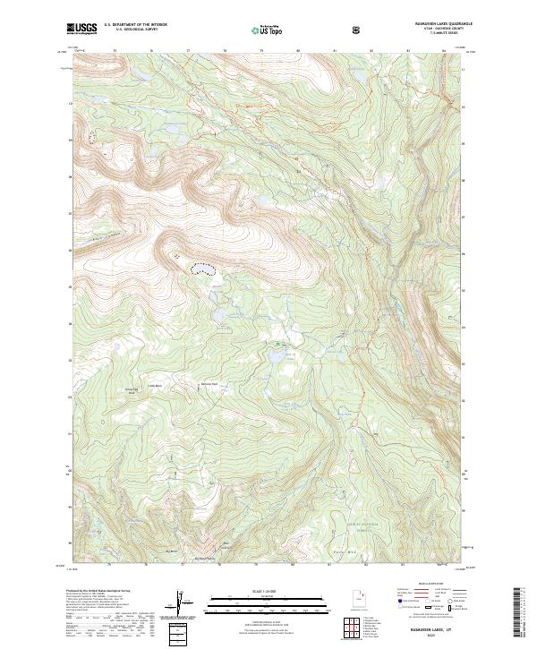
2023 Map of Rasmussen Lakes
USGS Topo · Published 2023About this map
The High Uintas Wilderness dominates the western portion of this high-altitude landscape, where glacial features have carved deep basins such as Little Basin and the amphitheater containing Cirque Lake. The namesake Rasmussen Lakes sit perched at the head of a drainage system that feeds the West Fork Whiterocks River, illustrating the complex hydrology of the Ashley National Forest. Higher elevations are marked by prominent summits like Goose Egg Peak and Pole Mtn, while the interior provides evidence of ancient water paths through the Pole Creek Sink.
Find a feature on this map
39 named features on this map. Tap any name to fly to it.
Don’t see what you’re looking for? This feature index may not catch every label — zoom into the map to look around manually.
Map Details
Editions of this 2023 Rasmussen Lakes Map
This is the sole edition of this map. No revisions or reprints were ever made.
Other maps of this area

1885 · Ashley
USGS Topo · 1:250,000

1885 · Uinta
USGS Topo · 1:250,000

1905 · Gilbert Peak
USGS Topo · 1:125,000

1906 · Gilbert Peak
USGS Topo · 1:125,000

1906 · Marsh Peak
USGS Topo · 1:125,000

1908 · Marsh Peak
USGS Topo · 1:125,000

1954 · Salt Lake City
USGS Topo · 1:250,000

1954 · Vernal
USGS Topo · 1:250,000

1958 · Vernal
USGS Topo · 1:250,000

1958 · Salt Lake City
USGS Topo · 1:250,000