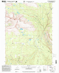
1996 Map of Rasmussen Lakes
USGS Topo · Published 1999About this map
The High Uintas Wilderness dominates the western portion of this 1996 update, featuring a landscape defined by glacial activity and high-altitude hydrology. The map illustrates a concentration of alpine basins, including the namesake Rasmussen Lakes and the tiered system of Upper Rock Lake, Middle Rock Lake, and Lower Rock Lake. Within the Ashley National Forest, the terrain drops toward the Whiterocks River and its forks, where the West Fork Whiterocks Bridge provides a rare point of engineered infrastructure in an otherwise primitive area. Significant landmarks for navigation and land management include Pole Mountain and the Vernal Roosevelt Ranger District Boundary. For the researcher, the map preserves the specific locations of high-country springs and meadows such as Bennion Park and Big Bend Hollow Spring, which have long served as vital landmarks for seasonal high-country travel and forest management.
Find a feature on this map
38 named features on this map. Tap any name to fly to it.
Don’t see what you’re looking for? This feature index may not catch every label — zoom into the map to look around manually.
Map Details
Editions of this 1996 Rasmussen Lakes Map
This is the sole edition of this map. No revisions or reprints were ever made.
Other maps of this area

1885 · Ashley
USGS Topo · 1:250,000

1885 · Uinta
USGS Topo · 1:250,000

1905 · Gilbert Peak
USGS Topo · 1:125,000

1906 · Gilbert Peak
USGS Topo · 1:125,000

1906 · Marsh Peak
USGS Topo · 1:125,000

1908 · Marsh Peak
USGS Topo · 1:125,000

1954 · Salt Lake City
USGS Topo · 1:250,000

1954 · Vernal
USGS Topo · 1:250,000

1958 · Vernal
USGS Topo · 1:250,000

1958 · Salt Lake City
USGS Topo · 1:250,000