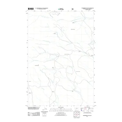
2011 Map of Raspberry Butte
USGS Topo · Published 2011About this map
Raspberry Butte rises above a landscape defined by scattered ranching and agricultural operations in this corner of Sweet Grass County. The map documents the enduring footprint of family-named landholdings, such as the Grosfield Homestead and Beley Homestead, which are clustered around the drainage of Swamp Creek. This 2011 survey reveals a persistent pattern of rural settlement where most named locations refer to specific family estates rather than centralized towns, emphasizing the decentralized nature of Montana’s high-country ranching culture.
Find a feature on this map
27 named features on this map. Tap any name to fly to it.
Don’t see what you’re looking for? This feature index may not catch every label — zoom into the map to look around manually.
Map Details
Editions of this 2011 Raspberry Butte Map
This is the sole edition of this map. No revisions or reprints were ever made.
Other maps of this area

1886 · Little Belt Mts.
USGS Topo · 1:250,000

1891 · Livingston
USGS Topo · 1:250,000

1893 · Livingston
USGS Topo · 1:250,000

1894 · Little Belt Mts.
USGS Topo · 1:250,000

1897 · Little Belt Mts.
USGS Topo · 1:250,000

1898 · Little Belt Mts.
USGS Topo · 1:250,000

1902 · Little Belt Mts.
USGS Topo · 1:250,000

1947 · Bozeman
USGS Topo · 1:250,000

1948 · Bozeman
USGS Topo · 1:250,000

1948 · White Sulphur Springs
USGS Topo · 1:250,000