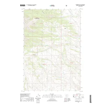
2020 Map of Raspberry Butte
USGS Topo · Published 2020About this map
The Crazy Mountains dominate this section of Gallatin National Forest in Sweet Grass County. This high-elevation terrain is defined by the steep slopes of Raspberry Butte and Kid Royal Mtn, providing a look at the complex drainages that feed the region's river systems. The northern half of the quadrangle is characterized by a high concentration of water features, including the Beley Lakes and Swamp Lake, which feed into the S Fork Swamp Cr and Swamp Cr. A lone corridor of human activity, Swamp Creek Rd, provides access to the eastern edges of these peaks. In the south, the landscape is carved by numerous namesake streams such as Sawmill Cr, Bailey Cr, and Hunters Cr, reflecting the drainage patterns of the N Fork Little Timber Cr and W Fork Little Timber Cr as they flow out from the mountainous core.
Find a feature on this map
24 named features on this map. Tap any name to fly to it.
Don’t see what you’re looking for? This feature index may not catch every label — zoom into the map to look around manually.
Map Details
Editions of this 2020 Raspberry Butte Map
This is the sole edition of this map. No revisions or reprints were ever made.
Other maps of this area

1886 · Little Belt Mts.
USGS Topo · 1:250,000

1891 · Livingston
USGS Topo · 1:250,000

1893 · Livingston
USGS Topo · 1:250,000

1894 · Little Belt Mts.
USGS Topo · 1:250,000

1897 · Little Belt Mts.
USGS Topo · 1:250,000

1898 · Little Belt Mts.
USGS Topo · 1:250,000

1902 · Little Belt Mts.
USGS Topo · 1:250,000

1947 · Bozeman
USGS Topo · 1:250,000

1948 · Bozeman
USGS Topo · 1:250,000

1948 · White Sulphur Springs
USGS Topo · 1:250,000