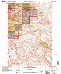
2000 Map of Raspberry Butte
USGS Topo · Published 2005About this map
Grosfield Homestead and a network of other family sites define the high-altitude ranching landscape within the Crazy Mountains at the turn of the millennium. This topography is dominated by the steep slopes of Raspberry Butte and Kid Royal Mtn, where elevations rise sharply from the watercourses of Big Timber Creek and its southern fork. The distribution of sites like the Hauge Homestead and Berland Homestead along the drainages of Swamp Creek and Little Timber Creek illustrates the historical reliance on narrow valley floors for settlement in the Gallatin National Forest. The presence of numerous named homesteads, including the Clay Morris Homestead and Shook Homestead, provides a detailed record of land use and family history in this remote section of Sweet Grass County, where access is often limited to 4WD tracks.
Find a feature on this map
27 named features on this map. Tap any name to fly to it.
Don’t see what you’re looking for? This feature index may not catch every label — zoom into the map to look around manually.
Map Details
Editions of this 2000 Raspberry Butte Map
This is the sole edition of this map. No revisions or reprints were ever made.
Other maps of this area

1886 · Little Belt Mts.
USGS Topo · 1:250,000

1891 · Livingston
USGS Topo · 1:250,000

1893 · Livingston
USGS Topo · 1:250,000

1894 · Little Belt Mts.
USGS Topo · 1:250,000

1897 · Little Belt Mts.
USGS Topo · 1:250,000

1898 · Little Belt Mts.
USGS Topo · 1:250,000

1902 · Little Belt Mts.
USGS Topo · 1:250,000

1947 · Bozeman
USGS Topo · 1:250,000

1948 · Bozeman
USGS Topo · 1:250,000

1948 · White Sulphur Springs
USGS Topo · 1:250,000