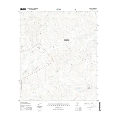
2016 Map of Ratcliff
USGS Topo · Published 2016About this map
Davy Crockett National Forest dominates this landscape in Houston County, where a network of family cemeteries and small-scale water features reveals a history of rural settlement within the timberlands. The town of Ratcliff sits in the southeast, positioned near the recreational waters of Ratcliff Lake. The map is particularly notable for its numerous small burial grounds and family-named landmarks, such as the Patton Family Graves and Vaughn Family Grants, which provide essential points of reference for genealogists studying the area's early residents. The terrain is defined by a complex system of creeks and bayous, including N Fork Cochino Bayou and S Fork Cochino Bayou. Unique topographical notations like the Wilcox Branch and Chinquapin Merge highlight the specific hydrological junctions that have shaped local property lines and road placements for generations.
Find a feature on this map
62 named features on this map. Tap any name to fly to it.
Don’t see what you’re looking for? This feature index may not catch every label — zoom into the map to look around manually.
Map Details
Editions of this 2016 Ratcliff Map
This is the sole edition of this map. No revisions or reprints were ever made.
Other maps of this area

1946 · Alto
USGS Topo · 1:62,500

1950 · Crockett NE
USGS Topo · 1:24,000

1950 · Kennard NE
USGS Topo · 1:24,000

1950 · Ratcliff
USGS Topo · 1:24,000

1950 · Centralia
USGS Topo · 1:24,000

1951 · Kennard
USGS Topo · 1:24,000

1951 · Centralia
USGS Topo · 1:24,000

1951 · Berea
USGS Topo · 1:24,000

1951 · Crockett NE
USGS Topo · 1:24,000

1951 · Kennard NE
USGS Topo · 1:24,000