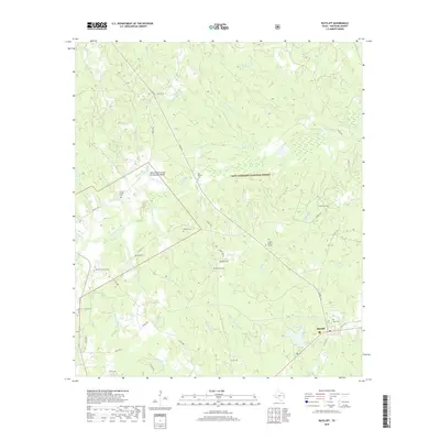
2019 Map of Ratcliff
USGS Topo · Published 2019About this map
Davy Crockett National Forest dominates the landscape of this Houston County region, where the piney woods are dissected by a complex network of creeks and branches. The settlement of Ratcliff sits in the southeast corner, serving as a focal point for the surrounding rural homesteads. This 2019 survey provides a precise look at local genealogy through numerous family burial sites and small cemeteries, including the Patton Family Graves, Vaughn Family Graves, and Moffit Creath Cem. The hydrologic pattern is particularly dense here, featuring the N Fork Cochino Bayou and S Fork Cochino Bayou, along with various named water bodies like Cook Lake and the unique Wilcox Branch and Chinquapin Merge. These drainage systems historically dictated the placement of early roads and family landholdings.
Find a feature on this map
63 named features on this map. Tap any name to fly to it.
Don’t see what you’re looking for? This feature index may not catch every label — zoom into the map to look around manually.
Map Details
Editions of this 2019 Ratcliff Map
This is the sole edition of this map. No revisions or reprints were ever made.
Other maps of this area

1946 · Alto
USGS Topo · 1:62,500

1950 · Crockett NE
USGS Topo · 1:24,000

1950 · Kennard NE
USGS Topo · 1:24,000

1950 · Ratcliff
USGS Topo · 1:24,000

1950 · Centralia
USGS Topo · 1:24,000

1951 · Kennard
USGS Topo · 1:24,000

1951 · Centralia
USGS Topo · 1:24,000

1951 · Berea
USGS Topo · 1:24,000

1951 · Crockett NE
USGS Topo · 1:24,000

1951 · Kennard NE
USGS Topo · 1:24,000