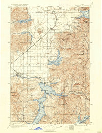
1903 Map of Rathdrum
USGS Topo · Published 1934About this map
Coeur d'Alene Lake and the vast Rathdrum Prairie dominate this turn-of-the-century landscape, surveyed years before the massive timber booms and regional growth of the mid-20th century. The settlement at Rathdrum stands as a primary hub along the Northern Pacific railroad, which cuts diagonally across the prairie. To the south, the military history of the region is anchored by Fort Sherman at the head of the Spokane River, while nearby Post Falls marks an early industrial point along the waterway. The map captures a transition from open prairie and rugged mountain peaks like Mica Peak to the burgeoning lakefront developments at Silver Beach and Steamboat Landing on Pend Oreille Lake. Numerous bays and points, such as Mica Bay and Echo Bay, illustrate the intricate shoreline of the region's massive glacial lakes during the early years of Idaho's statehood.
Find a feature on this map
68 named features on this map. Tap any name to fly to it.
Don’t see what you’re looking for? This feature index may not catch every label — zoom into the map to look around manually.
Map Details
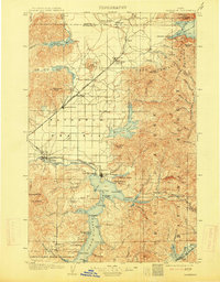
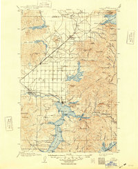
Editions of this 1903 Rathdrum Map
4 editions found
Other maps of this area

1901 · Sandpoint
USGS Topo · 1:125,000

1901 · Spokane
USGS Topo · 1:125,000

1903 · Oakesdale
USGS Topo · 1:125,000

1903 · Rathdrum
USGS Topo · 1:125,000

1905 · Oakesdale
USGS Topo · 1:125,000

1909 · Cataldo
USGS Topo · 1:125,000

1911 · Cataldo
USGS Topo · 1:125,000

1911 · Priest Lake
USGS Topo · 1:250,000

1911 · Sandpoint
USGS Topo · 1:125,000

1913 · Priest Lake
USGS Topo · 1:250,000