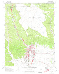
1971 Map of Raton
USGS Topo · Published 1974About this map
Raton serves as a critical gateway between the high plains and the Sangre de Cristo Mountains, anchored by the historic Raton Pass at the Colorado-New Mexico border. This 1971 survey documents the town's industrial and transit infrastructure, where the Atchison Topeka and Santa Fe Railroad winds through steep canyons alongside the Santa Fe Trail (Approx). The landscape is defined by the legacy of the Beaubien and Miranda (Maxwell) land grant, with the terrain falling away from the massive Bartlett Mesa. In the canyons west of town, the remnants of the area's coal mining heritage are visible at Gardiner and Blossburg, including a series of Coke Ovens near Dillon Canyon. The community’s civic life is well-represented through numerous institutions, such as Miners Hospital, St Patricks Sch, and the Mt Calvary Cem, providing a detailed view of this mountain crossroads at the start of the 1970s.
Find a feature on this map
50 named features on this map. Tap any name to fly to it.
Don’t see what you’re looking for? This feature index may not catch every label — zoom into the map to look around manually.
Map Details
Editions of this 1971 Raton Map
This is the sole edition of this map. No revisions or reprints were ever made.
Other maps of this area

1891 · Spanish Peaks
USGS Topo · 1:125,000

1892 · Elmoro
USGS Topo · 1:125,000

1893 · Spanish Peaks
USGS Topo · 1:125,000

1893 · Elmoro
USGS Topo · 1:125,000

1895 · Spanish Peaks
USGS Topo · 1:125,000

1897 · Elmoro
USGS Topo · 1:125,000

1897 · Spanish Peaks
USGS Topo · 1:125,000

1900 · Spanish Peaks
USGS Topo · 1:125,000

1912 · Raton
USGS Topo · 1:62,500

1914 · Raton
USGS Topo · 1:62,500