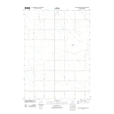
2012 Map of Rattlesnake Butte West
USGS Topo · Published 2012About this map
Rattlesnake Butte stands as a prominent elevation in this segment of Tripp County, marking a prairie landscape defined by a precise grid of rural roads and drainage patterns. The ephemeral waters of No Moccasin Cr meander across the northern and eastern portions of the quadrangle, carving subtle paths through the high plains. The area is characterized by large-scale agricultural land divisions, with primary north-south corridors like 324th Ave and 322nd Ave intersecting east-west routes such as 270th St and 275th St. This 2012 survey illustrates the enduring section-line road system typical of South Dakota's farming and ranching country, showing how modern infrastructure continues to follow the historical township and range boundaries established over a century ago.
Find a feature on this map
15 named features on this map. Tap any name to fly to it.
Don’t see what you’re looking for? This feature index may not catch every label — zoom into the map to look around manually.
Map Details
Editions of this 2012 Rattlesnake Butte West Map
This is the sole edition of this map. No revisions or reprints were ever made.
Other maps of this area

1955 · Mitchell
USGS Topo · 1:250,000

1959 · Mitchell
USGS Topo · 1:250,000

1971 · Hamill SE
USGS Topo · 1:24,000

1971 · Colome
USGS Topo · 1:24,000

1971 · Rattlesnake Butte East
USGS Topo · 1:24,000

1971 · Hamill
USGS Topo · 1:24,000

1971 · Rattlesnake Butte West
USGS Topo · 1:24,000

1971 · Colome SE
USGS Topo · 1:24,000

1982 · King Dam
USGS Topo · 1:25,000

1982 · Winner North
USGS Topo · 1:25,000