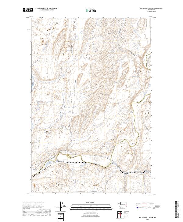
2023 Map of Rattlesnake Canyon
USGS Topo · Published 2023About this map
Gordon sits at the southern edge of this landscape where the Palouse River and Willow Creek converge near the Adams and Whitman County line. This region is defined by its complex drainage systems and semi-arid basins, featuring a chain of water bodies including Negro Lake, Kennedy Lake, and the connected Twin Lakes and Little Twin Lakes. The terrain is deeply inscribed by Rattlesnake Canyon in the northeast, reflecting the geological history of the Channeled Scablands.
Find a feature on this map
23 named features on this map. Tap any name to fly to it.
Don’t see what you’re looking for? This feature index may not catch every label — zoom into the map to look around manually.
Map Details
Editions of this 2023 Rattlesnake Canyon Map
This is the sole edition of this map. No revisions or reprints were ever made.
Other maps of this area

1948 · Starbuck
USGS Topo · 1:62,500

1950 · La Crosse
USGS Topo · 1:62,500

1950 · Starbuck
USGS Topo · 1:62,500

1950 · Hay
USGS Topo · 1:62,500

1950 · Benge
USGS Topo · 1:62,500

1952 · Hay
USGS Topo · 1:62,500

1952 · La Crosse
USGS Topo · 1:62,500

1952 · Benge
USGS Topo · 1:62,500

1953 · Walla Walla
USGS Topo · 1:250,000

1955 · Pullman
USGS Topo · 1:250,000