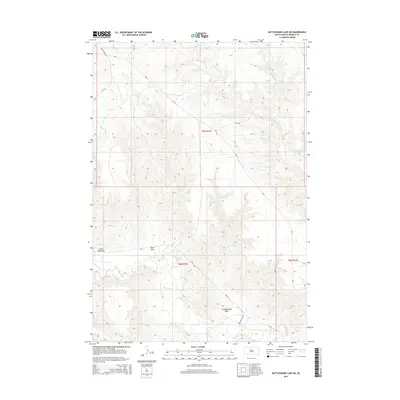
2015 Map of Rattlesnake Lake NE
USGS Topo · Published 2015About this map
Cherry Cr meanders through the southern portion of this landscape in Ziebach and South Dakota counties, defining a network of drainage features across the high plains. The terrain is deeply inscribed by seasonal watercourses and topographic depressions such as Little Dog Draw, Horn Draw, and Straighthead Draw. To the north, the headwaters of Little Cottonwood Cr and its E Fork Little Cottonwood Cr flow through a region marked by Bureau of Indian Affairs routes, including Bia-15 and Bia-5. This 2015 survey illustrates a sparsely settled environment where the primary infrastructure consists of rural corridors like Cherry Creek Rd and Tipi J Rd, highlighting the enduring reliance on natural drainage patterns and established trail-routes in this part of the Dakotas.
Find a feature on this map
15 named features on this map. Tap any name to fly to it.
Don’t see what you’re looking for? This feature index may not catch every label — zoom into the map to look around manually.
Map Details
Editions of this 2015 Rattlesnake Lake NE Map
This is the sole edition of this map. No revisions or reprints were ever made.
Other maps of this area

1954 · Pierre
USGS Topo · 1:250,000

1955 · Rattlesnake Lake SE
USGS Topo · 1:24,000

1955 · Rattlesnake Lake SW
USGS Topo · 1:24,000

1955 · Rattlesnake Lake
USGS Topo · 1:24,000

1955 · Rattlesnake Lake NE
USGS Topo · 1:24,000

1956 · Cherry Creek NW
USGS Topo · 1:24,000

1956 · Cherry Creek
USGS Topo · 1:24,000

1958 · Pierre
USGS Topo · 1:250,000

1981 · High Elk Hill SW
USGS Topo · 1:24,000

1982 · Longbrake Ranch
USGS Topo · 1:24,000