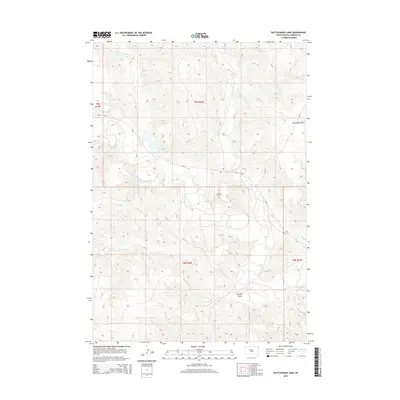
2015 Map of Rattlesnake Lake
USGS Topo · Published 2015About this map
Rattlesnake Lake and the winding course of Cherry Cr define this landscape within the Cheyenne River Indian Reservation in South Dakota. The drainage patterns are highly detailed, showing the natural migration of water through Old Channel Cherry Cr and the numerous tributaries like Felix Cr and Ash Cr that carve the terrain. A significant site for local history is the Little Dog Cem, located north of the creek near Little Dog Draw. The map documents a sparse road network managed by the Bureau of Indian Affairs, including Bia-6 and Bia-15, which navigate the draws and ridges. This 2015 survey reflects a landscape where traditional land boundaries like t9n r20e intersect with natural landmarks such as Red Bull Draw, providing a clear view of the rural geography of Ziebach County.
Find a feature on this map
16 named features on this map. Tap any name to fly to it.
Don’t see what you’re looking for? This feature index may not catch every label — zoom into the map to look around manually.
Map Details
Editions of this 2015 Rattlesnake Lake Map
This is the sole edition of this map. No revisions or reprints were ever made.
Other maps of this area

1954 · Pierre
USGS Topo · 1:250,000

1955 · Rattlesnake Lake SE
USGS Topo · 1:24,000

1955 · Rattlesnake Lake SW
USGS Topo · 1:24,000

1955 · Rattlesnake Lake
USGS Topo · 1:24,000

1955 · Rattlesnake Lake NE
USGS Topo · 1:24,000

1955 · Bridger SE
USGS Topo · 1:24,000

1958 · Pierre
USGS Topo · 1:250,000

1982 · Bridger NE
USGS Topo · 1:24,000

1982 · Red Scaffold
USGS Topo · 1:24,000

1982 · Longbrake Ranch
USGS Topo · 1:24,000