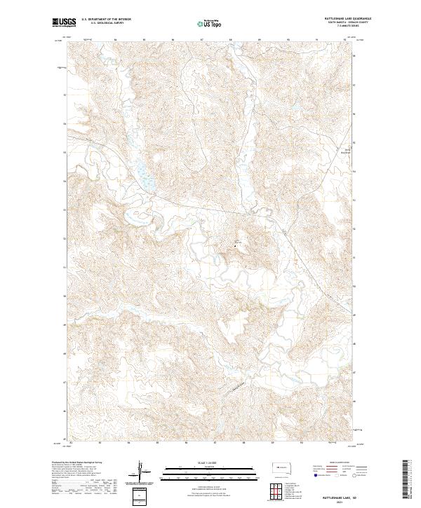
2021 Map of Rattlesnake Lake
USGS Topo · Published 2021About this map
Cherry Cr and its complex drainage network define this Ziebach County landscape, where the shifting path of the water is evidenced by the Old Channel Cherry Cr. The area is characterized by traditional land divisions and a sparse network of roads, including Bia Hwy 6 and various county routes. Local history is anchored by the Little Dog Cem, located north of the creek, which serves as a significant genealogical marker for the region. The map highlights the rugged topography of the High Plains, carved by numerous seasonal waterways such as Felix Cr, Ash Cr, and Rattlesnake Cr. Landforms like Little Dog Draw and Red Bull Draw provide further detail on the intricate relief of this South Dakota prairie, offering a clear record of the area's natural boundaries and isolated landmarks.
Find a feature on this map
14 named features on this map. Tap any name to fly to it.
Don’t see what you’re looking for? This feature index may not catch every label — zoom into the map to look around manually.
Map Details
Editions of this 2021 Rattlesnake Lake Map
This is the sole edition of this map. No revisions or reprints were ever made.
Other maps of this area

1954 · Pierre
USGS Topo · 1:250,000

1955 · Rattlesnake Lake SE
USGS Topo · 1:24,000

1955 · Rattlesnake Lake SW
USGS Topo · 1:24,000

1955 · Rattlesnake Lake
USGS Topo · 1:24,000

1955 · Rattlesnake Lake NE
USGS Topo · 1:24,000

1955 · Bridger SE
USGS Topo · 1:24,000

1958 · Pierre
USGS Topo · 1:250,000

1982 · Bridger NE
USGS Topo · 1:24,000

1982 · Red Scaffold
USGS Topo · 1:24,000

1982 · Longbrake Ranch
USGS Topo · 1:24,000