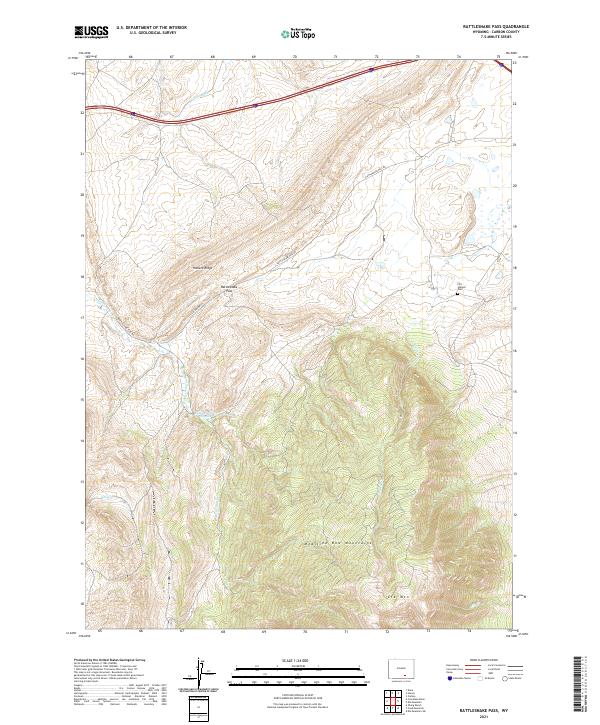
2021 Map of Rattlesnake Pass
USGS Topo · Published 2021About this map
Elk Mtn and the northern reaches of the Medicine Bow Mountains dominate this high-altitude landscape in Carbon County. The map provides a detailed look at the geographic corridor through Rattlesnake Pass, where the terrain transitions from the rugged Halleck Ridge toward the lowlands near Kinney Cr. Local history is anchored by the Fort Halleck Cem, a significant marker of early settlement and travel in the region.
Find a feature on this map
19 named features on this map. Tap any name to fly to it.
Don’t see what you’re looking for? This feature index may not catch every label — zoom into the map to look around manually.
Map Details
Editions of this 2021 Rattlesnake Pass Map
This is the sole edition of this map. No revisions or reprints were ever made.
Other maps of this area

1893 · Fort Steele
USGS Topo · 1:125,000

1914 · Hanna
USGS Topo · 1:62,500

1914 · Saddleback Hills
USGS Topo · 1:62,500

1921 · Saddleback Hills
USGS Topo · 1:62,500

1954 · Rawlins
USGS Topo · 1:250,000

1955 · Coal Bank Basin
USGS Topo · 1:24,000

1955 · Elk Mountain
USGS Topo · 1:24,000

1955 · Elk Mountain SW
USGS Topo · 1:24,000

1955 · Oberg Ranch
USGS Topo · 1:24,000

1955 · Rattlesnake Pass
USGS Topo · 1:24,000