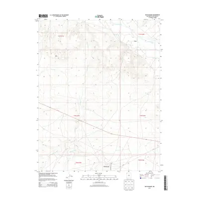
2013 Map of Rattlesnake
USGS Topo · Published 2013About this map
The San Juan River flows across the northern section of this landscape, its waters diverted into the Cudei Ditch to support the small community of Cudei. To the south, the settlement of Rattlesnake sits near the intersection of Indian Service Route 5010 and N 5020. The terrain is defined by a network of seasonal drainage patterns, including the prominent Shiprock Wash, which cuts a path southward from the river towards the Gray Hills.
Find a feature on this map
18 named features on this map. Tap any name to fly to it.
Don’t see what you’re looking for? This feature index may not catch every label — zoom into the map to look around manually.
Map Details
Editions of this 2013 Rattlesnake Map
This is the sole edition of this map. No revisions or reprints were ever made.
Other maps of this area

1889 · Chaco
USGS Topo · 1:250,000

1892 · Chaco
USGS Topo · 1:250,000

1927 · Sulphur Spring
USGS Topo · 1:96,000

1928 · Kirtland
USGS Topo · 1:125,000

1932 · Kirtland
USGS Topo · 1:125,000

1934 · Ship Rock
USGS Topo · 1:62,500

1934 · Chimney Rock
USGS Topo · 1:62,500

1934 · Rattlesnake
USGS Topo · 1:62,500

1936 · Chimney Rock
USGS Topo · 1:62,500

1937 · Ship Rock
USGS Topo · 1:62,500
Featured Places
- Shiprock Agency
- Rattlesnake, Shiprock Agency
- Gadii'ahi, Shiprock Agency
- San Juan County, NM
- United States