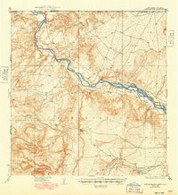
1937 Map of Rattlesnake
USGS Topo · Published 1949About this map
The Navajo Indian Reservation dominates this 1930s landscape where the high desert of San Juan County meets the borders of three other states. The San Juan River carves a complex, braided path across the northern half of the quadrangle, joined by the Mancos River near the iconic Four Corners marker. This survey captures a remote region defined by its ephemeral drainage systems, including Tohache Wash and Little Ship Rock Wash, which signal the stark hydrology of the Four Corners area. Small outposts such as Rattlesnake and Cudai appear as isolated settlements connected by unimproved roads. The topography is marked by significant elevation changes, particularly around the southern washes and Malpais Arroyo, documenting a period when the infrastructure of the American Southwest was still primarily shaped by natural watercourses and the boundaries of indigenous lands.
Find a feature on this map
16 named features on this map. Tap any name to fly to it.
Don’t see what you’re looking for? This feature index may not catch every label — zoom into the map to look around manually.
Map Details
Editions of this 1937 Rattlesnake Map
3 editions found

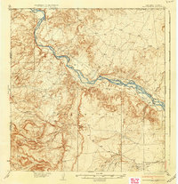
Other maps of this area

1886 · Abajo
USGS Topo · 1:250,000

1889 · Chaco
USGS Topo · 1:250,000

1892 · Abajo
USGS Topo · 1:250,000

1892 · Chaco
USGS Topo · 1:250,000

1892 · Canyon De Chelly
USGS Topo · 1:250,000

1893 · Abajo
USGS Topo · 1:250,000

1927 · Sulphur Spring
USGS Topo · 1:96,000

1928 · Kirtland
USGS Topo · 1:125,000

1932 · Kirtland
USGS Topo · 1:125,000

1934 · Ship Rock
USGS Topo · 1:62,500
Featured Places
- Shiprock Agency
- Gadii'ahi, Shiprock Agency
- Rattlesnake, Shiprock Agency
- San Juan County, NM
- Montezuma County, CO