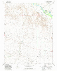
1983 Map of Rattlesnake
USGS Topo · Published 1984About this map
The San Juan River flows through the northern reaches of this territory, supporting agricultural life via the Cudei Ditch and Ditch Number Nine. Located within the Navajo Indian Reservation, the landscape is defined by the transition from the Gray Hills to the alluvial plains. This 1983 survey captures the intensive resource extraction era of the region, centering on the Oil Field and the eponymous settlement of Rattlesnake.
Find a feature on this map
16 named features on this map. Tap any name to fly to it.
Don’t see what you’re looking for? This feature index may not catch every label — zoom into the map to look around manually.
Map Details
Editions of this 1983 Rattlesnake Map
This is the sole edition of this map. No revisions or reprints were ever made.
Other maps of this area

1889 · Chaco
USGS Topo · 1:250,000

1892 · Chaco
USGS Topo · 1:250,000

1927 · Sulphur Spring
USGS Topo · 1:96,000

1928 · Kirtland
USGS Topo · 1:125,000

1932 · Kirtland
USGS Topo · 1:125,000

1934 · Ship Rock
USGS Topo · 1:62,500

1934 · Chimney Rock
USGS Topo · 1:62,500

1934 · Rattlesnake
USGS Topo · 1:62,500

1936 · Chimney Rock
USGS Topo · 1:62,500

1937 · Ship Rock
USGS Topo · 1:62,500
Featured Places
- Shiprock Agency
- Gadii'ahi, Shiprock Agency
- Rattlesnake, Shiprock Agency
- San Juan County, NM
- United States